


Farming today is no longer just about soil, water, and sunlight. Technology now plays a major role in helping farmers grow more food with fewer resources. One of the most powerful tools available today is satellite technology. If you want to understand how to monitor crop health using satellites, this guide will explain everything in a very simple and practical way.
This article is designed for farmers, agribusiness owners, and anyone interested in agriculture in the United States. It uses clear language, real-world examples, and updated insights so you can apply what you learn right away.
What Does It Mean to Monitor Crop Health Using Satellites
To understand how to monitor crop health using satellites, we first need to know what it actually means.
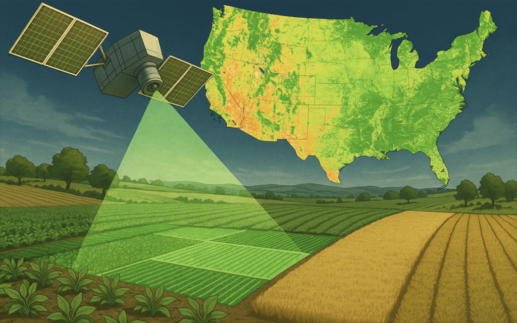
Satellite crop monitoring is the process of using images and data collected from satellites orbiting the Earth to check how crops are growing. These satellites capture information about plant health, moisture levels, soil condition, and more.
Instead of walking across every acre of land, farmers can now see the condition of their entire farm from space. This saves time, reduces costs, and improves decision-making.
Satellites do not just take pictures like a normal camera. They collect data using special sensors that can detect things the human eye cannot see. This includes plant stress, nutrient levels, and even early signs of disease.
Why Satellite Monitoring Is Important for Farmers
Understanding how to monitor crop health using satellites is important because it helps solve many common farming problems.
Farmers often struggle with issues like uneven crop growth, pest attacks, drought stress, and soil problems. These issues can reduce yield and increase costs if not detected early.
Satellite monitoring helps by providing early warnings. It allows farmers to:
- Detect crop stress before it becomes visible
- Use water more efficiently
- Apply fertilizers only where needed
- Reduce pesticide use
- Improve overall crop yield
In the United States, where farms can cover hundreds or even thousands of acres, this technology is especially useful. It helps farmers manage large areas without missing important details.
How Satellites Collect Crop Data
To fully understand how to monitor crop health using satellites, it is important to know how satellites collect data.
Satellites use sensors that capture light reflected from crops. Plants reflect light differently depending on their health. Healthy plants reflect more near-infrared light and less visible light, while unhealthy plants show different patterns.
Also Read: What Is a Lifestyle Hotel? A Complete Guide for Modern Travelers
These sensors measure different wavelengths of light, including:
- Visible light
- Infrared light
- Thermal energy
This data is then processed into maps and images that farmers can use.
There are two main types of satellites used in agriculture:
- Optical satellites
These capture images similar to photographs but with additional data layers. - Radar satellites
These can collect data even through clouds and at night, making them very reliable.
Understanding Vegetation Indices
One of the most important parts of how to monitor crop health using satellites is understanding vegetation indices.
A vegetation index is a number that shows how healthy plants are. The most commonly used index is NDVI, which stands for Normalized Difference Vegetation Index.
NDVI measures the difference between near-infrared light and red light reflected by plants. It helps identify areas where crops are healthy or stressed.
Higher NDVI values usually mean:
- Healthy crops
- Strong growth
- Good moisture levels
Lower NDVI values may indicate:
- Water stress
- Nutrient deficiency
- Disease or pest damage
Farmers use NDVI maps to quickly identify problem areas in their fields.
Step-by-Step Process: How to Monitor Crop Health Using Satellites
Now let’s break down how to monitor crop health using satellites into simple steps.
Step 1: Choose a satellite monitoring platform
Farmers usually use online tools or apps that provide satellite data. Many platforms are designed specifically for agriculture.
Step 2: View your field maps
These platforms show maps of your farm with different colors representing crop health.
Step 3: Analyze vegetation indices
Look at NDVI or similar indices to identify healthy and unhealthy areas.
Step 4: Identify problem zones
Focus on areas with lower values or unusual patterns.
Step 5: Take action
Visit those areas physically or use equipment to apply water, fertilizer, or pesticides as needed.
Step 6: Monitor changes over time
Satellite data is updated regularly, so you can track improvements or worsening conditions.
Key Benefits of Satellite Crop Monitoring
Understanding how to monitor crop health using satellites also means understanding its benefits.
Satellite monitoring offers several advantages:
Better decision-making
Farmers can make informed choices based on real data instead of guesswork.
Cost savings
By targeting specific areas, farmers reduce waste of water, fertilizers, and chemicals.
Early detection
Problems can be identified before they spread across the field.
Time efficiency
Large farms can be monitored quickly without manual inspection.
Improved yield
Healthy crops lead to better production and higher profits.
Real-Life Use Cases in the United States
In the US, many farmers are already using satellite technology to improve their operations.
For example, corn and soybean farmers in the Midwest use satellite data to monitor crop growth throughout the season. They can detect stress caused by drought or pests and take action quickly.
In California, where water is limited, farmers use satellite data to optimize irrigation. This helps save water while maintaining crop quality.
In Texas, satellite monitoring helps ranchers manage pasture health and grazing patterns.
These real-life examples show how powerful this technology can be when used correctly.
How Satellites Help with Irrigation Management
Water management is one of the most important aspects of farming. Knowing how to monitor crop health using satellites can greatly improve irrigation practices.
Satellites can measure soil moisture and plant water stress. This helps farmers know exactly when and where to water their crops.
Instead of watering the entire field, farmers can:
- Focus on dry areas
- Avoid overwatering
- Reduce water waste
This is especially important in regions facing drought or water restrictions.
Detecting Crop Diseases and Pests Early
One of the biggest advantages of learning how to monitor crop health using satellites is early detection of diseases and pests.
ALso Read: NTTUHFVV: A Complete Guide to Understanding, Uses, Benefits, and Future Potential
When crops are affected by disease or pests, their reflectance patterns change. Satellites can detect these changes before they are visible to the human eye.
This allows farmers to:
- Identify affected areas quickly
- Apply treatment only where needed
- Prevent spread to healthy crops
Early action can save entire fields from damage.
Soil Health and Nutrient Management
Satellite data can also provide insights into soil health. While satellites do not directly measure soil nutrients, they can detect patterns that indicate nutrient problems.
For example:
- Poor plant growth may suggest nitrogen deficiency
- Uneven growth may indicate soil issues
By combining satellite data with soil tests, farmers can improve nutrient management and apply fertilizers more effectively.
Challenges and Limitations of Satellite Monitoring
While learning how to monitor crop health using satellites is very useful, it is also important to understand its limitations.
Cloud cover
Optical satellites may not capture clear images during cloudy weather.
Resolution limits
Some satellites may not provide very detailed images for small fields.
Data interpretation
Farmers need basic knowledge to understand satellite data correctly.
Cost
Some advanced platforms may require a subscription.
Despite these challenges, technology is improving rapidly, and many of these limitations are being reduced.
Best Tools and Platforms for Satellite Crop Monitoring
There are several platforms available that make it easy to use satellite data.
These tools provide:
- NDVI maps
- Field analysis
- Alerts for crop stress
- Historical data tracking
Many platforms are user-friendly and designed for farmers with little technical experience.
Some even offer mobile apps, allowing farmers to check their fields anytime.
Future of Satellite Monitoring in Agriculture
The future of how to monitor crop health using satellites looks very promising.
New technologies are being developed, including:
Artificial intelligence
AI can analyze satellite data faster and provide smart recommendations.
Higher resolution satellites
New satellites provide more detailed images.
Real-time monitoring
Farmers can get updates almost instantly.
Integration with drones
Combining satellite data with drone images provides even better insights.
These advancements will make farming more efficient, sustainable, and productive.
Practical Tips for Farmers Getting Started
If you are new to satellite monitoring, here are some simple tips to help you start.
Start small
Begin with one field and learn how the system works.
Use free tools
Many platforms offer free versions or trial periods.
Compare data
Check satellite data with actual field conditions.
Learn gradually
Take time to understand indices like NDVI.
Stay consistent
Monitor your fields regularly for better results.
How Satellite Monitoring Supports Sustainable Farming
Sustainability is becoming more important in agriculture. Knowing how to monitor crop health using satellites helps farmers adopt eco-friendly practices.
Satellite monitoring supports sustainability by:
- Reducing chemical use
- Saving water
- Preventing soil degradation
- Lowering environmental impact
This not only benefits farmers but also protects natural resources for future generations.
Common Mistakes to Avoid
When learning how to monitor crop health using satellites, avoid these common mistakes:
Ignoring ground checks
Always verify satellite data with field visits.
Overreacting to data
Not all changes indicate serious problems.
Using only one index
Combine different data sources for better accuracy.
Not updating regularly
Outdated data can lead to wrong decisions.
Also Read: Awius: The Complete Guide to a Smart Business Technology Revolution
Conclusion
Understanding how to monitor crop health using satellites is no longer optional for modern farmers. It is becoming an essential part of successful agriculture.
Satellite technology provides valuable insights that help farmers make better decisions, reduce costs, and increase yields. It allows them to manage large fields efficiently and respond quickly to problems.
As technology continues to improve, satellite monitoring will become even more accessible and powerful. Farmers who adopt this approach early will have a strong advantage in the future.
FAQs About How to Monitor Crop Health Using Satellites
What is the best time to check satellite data for crops?
It is best to check satellite data regularly, such as once a week, to track changes and detect problems early.
Can small farmers use satellite monitoring?
Yes, many platforms are affordable and suitable for small farms as well as large operations.
Do satellites work in all weather conditions?
Radar satellites can work in cloudy conditions, but optical satellites may be affected by clouds.
Is satellite monitoring accurate?
Yes, it is very accurate when combined with field observations and proper analysis.
Do I need special training to use satellite data?
Basic knowledge is enough to get started, and many tools are designed for beginners.
Can satellite data replace field inspections?
No, it should be used together with field inspections for best results.
How often are satellite images updated?
This depends on the satellite, but many provide updates every few days.
Is satellite monitoring useful for all crops?
Yes, it can be used for most crops including corn, wheat, soybeans, fruits, and vegetables.
Can I use satellite monitoring for organic farming?
Yes, it is very helpful for organic farming because it reduces the need for chemicals.
What is the cost of satellite monitoring tools?
Costs vary, but there are free options and affordable plans available for farmers.